
When was the last time you attended a public consultation for the development of a new condominium building in your neighborhood? While not everyone may be interested in civic affairs, the fact is that they influence many aspects of home life and commuting to work. The new building might block the view of those that have been living there for 20 years. Bus stops which were conveniently close could be relocated. Fewer parking spaces might be available when more people move to the neighborhood. The list goes on. Urban planning attempts to optimize all the stakeholders: the developers, the citizens, and the administration of roads, schools, health facilities, waste management, etc. Digital solutions can bridge the gap between everyday citizens who might not have time or ability to attend a public consultation.
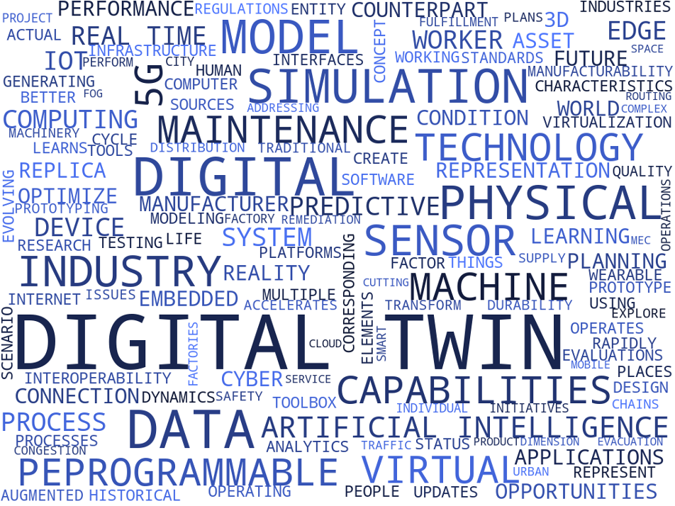
DIGITAL TWIN: THE BACKGROUND
Even though a Digital Twin concept has existed since 2002, it was formalized only in 2017 [1], becoming cost-effective to implement only thanks to the Internet of Things (IoT). The central elements of the digital twin concept are (i) physical objects that represent a real space, (ii) virtual objects that characterize a virtual space, and (iii) the link for the data flow between these two domains.
In simple terms, a DIGITAL TWIN is a virtual model of a process, product, service, or even system, and what is more important, it is a bridge between the physical and digital worlds. This combination of the virtual and physical worlds allows us to analyze data, monitor systems, and manage networks to predict problems, prevent their occurrence as well as prevent systems downtime, and also develop new opportunities using simulations. For instance, designing machines for a connected world, traditional tools may not be sufficient. Here, Digital Twin is paving the way to meet the new realities of future applications and systems.
To sum up, a virtual environment opens up opportunities for the physical world, ultimately, to transform EVERYTHING!
TECHNOLOGIES THAT ENABLE DIGITAL TWINS IN SMART CITIES
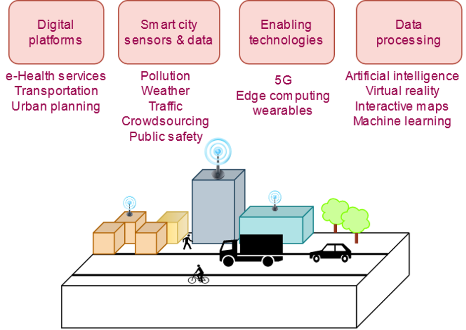
Digital twins are created and managed by various technologies that collect, compute, process, and visualize data. Among this variety of technologies, in this blog, we introduce just a set of implemented ones that allow digital twins to reach their true potential.
5TH GENERATION MOBILE NETWORK (5G) allows us to connect virtually everyone and everything, including machines, objects, devices, etc., with ultra-high speeds, low latency, and the ability to support high-density devices. 5G becomes a necessary digital dual accelerator since continuous real-time data flow between the physical and virtual objects is crucial for digital twins. In such scenarios, distributed processing at the cloud edge becomes critical.
INTERNET OF THINGS (IoT) represents the network of physical objects (things). IoT is one of the pillars of Digital Twins since sensors and platforms continually collect and organize the data sets from physical assets.
EDGE COMPUTING refers to a distributed computing paradigm that brings computation and data closer to the end-user. This distributed processing at the edge becomes paramount in digital twins scenarios. Edge Computing ensures the real-time data stream when digital twins are applied to optimize processes, speed, and accuracy.
DIGITAL PLATFORMS facilitate data exchanges between multiple objects in the system. Hence, the digital twin of the smart city becomes an urban platform for application development. In turn, cities can obtain a vision of what is lacking in each community and improve the environment and services.
ARTIFICIAL INTELLIGENCE (AI) AND BIG DATA (BD) complement each other, and Digital Twin as well. The more data we have, the better AI becomes. On the other hand, BD is merely useless without software to analyze it. These technologies support decision-making by city operators and allow them to automate operational tasks.
VISUALIZATION TECHNOLOGIES, such as Extended Reality (XR), including Augmented, Virtual, and Mixed Reality (AR/VR/MR) technologies, can bring digital twins to the next level, enhancing their performance, effectiveness, and accuracy and mainly affecting operations, training, design, and simulations.
DIGITAL TWINS IN THE CONTEXT OF THE URBAN ENVIRONMENTS
From the SMART CITY perspective, a digital twin represents a copy of the physical world, namely, a virtual model of a city. They are quickly becoming indispensable tools for visualizing a city’s ripple in real-time using multi-level data sources on buildings and facilities, urban infrastructure and systems, utilities and services, businesses and institutions, and even the movement of humans and smart objects.
Urban areas consist of many stakeholders: publicly-owned roads, sidewalks and parks, public transportation, companies that manage water supplies, sewage, gas pipes, electricity lines, and privately owned single family homes, residential buildings and office buildings. Physically an environment is constantly changing due to people, wildlife, vehicles, weather, and pollution. As a digital twin, exchanges between stakeholders and existing infrastructure can be modelled to aid in the understanding of this complex system. Digital maps can be used as a medium of communication between all parties. Nowadays, GIS (geographic information systems) provides the tools for building online interactive maps. A representation of an area in the real world can be enhanced with supplementary images, animations, video, and links. The experience can be further enhanced in 3D maps. The added dimension of the height, proportions, and look of the buildings allow one to better visualize the area. This might be useful to help remember what an area looks like, which tall buildings potentially obstruct sunlight or satellite signals, and to see how a potential project looks in relation to the rest of the neighbourhood.
A digital Smart City twin can be used as a tool to represent and engage all stakeholders in a project. The digital 2D or 3D maps can also have tools that incorporate feedback through comment sections, polling, and tools to demarcate an area for reference. Using digital twins, people do not have to be physically present at a public hearing, and can access it at their own convenience. Another benefit is that the digital twin can be updated at any given moment, so the latest changes can always be displayed. Interested parties can also be notified of updates or important events through email.
CHALLENGES TOWARDS DIGITAL TWIN ADOPTION IN SMART CITIES
Digital Twin runs in parallel with a number of technologies that provoke, at the same time, share challenges. Challenges that are triggered by IoT, Edge Computing, Data Analytics, etc., are the following: Data, Privacy, Security, Trust, and Expectations. In these fields, there are still issues related to IT infrastructure and seamless connectivity.
Another issue is that building and maintaining a digital twin requires a lot of investment, and while it seems that should be done by local and regional governments, the fact is that these institutions are often strapped for cash. Acquiring data can also be a challenge, as some maps are created and owned by private investors and are not available to the public. Therefore, some researchers [2] believe the digital twin should be people-powered by the help of open access datasets and open source software. Openstreetmap [3] is a great example of user-provided geographic features and details. Crowdsourcing data from the public has also been used to help create indoor maps [4], and in trying to model 3D buildings just with smartphones. These solutions could help minimize the costs, although these research developments are in their early stages.
However, we emphasize that there are challenges that are primarily associated with Digital Twins. Among these ones, we outline the most crucial challenges, namely, standardization, administration and cooperations. The former one reflects the global problem. Standardization aspects are especially critical when a digital tool should scale across cities in different countries. In contrast, the latter one is related to the local level. In this case, to make a Digital Urban Twin work effectively, tools for public administrations, cooperation, and co-creation are vital.
References
[1] Grieves, M., & Vickers, J. (2017). Digital twin: Mitigating unpredictable, undesirable emergent behavior in complex systems. In Transdisciplinary perspectives on complex systems (pp. 85-113). Springer, Cham.
[2] Dembski, F., Wössner, U., Letzgus, M., et al. (2020) Urban Digital Twins for Smart Cities and Citizens: The Case Study of Herrenberg, Germany. Sustainability 2020, 12, 2307;
[3] OpenStreetMap® is open data, licensed under the Open Data Commons Open Database License (ODbL) by theOpenStreetMap Foundation (OSMF). https://www.openstreetmap.org/
[4] Lines, T. and Basiri, A. (2019) Simulating and Modeling the Signal Attenuation of Wireless Local Area Network for Indoor Positioning. In: GeoSim ’19: Proceedings of the 2nd ACM SIGSPATIAL International Workshop on GeoSpatial Simulation, Chicago, IL, USA, 05 Nov 2019, pp. 9-15. ISBN 9781450369565 (doi:10.1145/3356470.3365527)
by Sylvia Holcer and Olga Chukhno